Central and Northwest India to hit 47°C on Sunday, rain likely in South and Northeast

India stands at a stark and dramatic meteorological crossroads on Sunday, May 24, simultaneously grappling with a punishing heatwave and the welcome, rain-bearing advance of the Southwest monsoon.
While vast swathes of Central and Northwest India are trapped in a blistering furnace, with temperatures breaching 47 degrees Celsius, the southern peninsula and northeastern states are bracing for intense downpours as the monsoon charts a steady course across the Bay of Bengal and Arabian Sea.
This extreme dichotomy highlights the complex atmospheric systems at play, leaving millions of citizens navigating either the desperate search for shade or the immediate need for umbrellas.
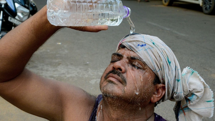
A relentless heatwave continues to bake Central, Northwest, and parts of Eastern India on Sunday, with no immediate relief in sight for several regions.
According to the India Meteorological Department (IMD), severe heatwave conditions are expected to prevail over Central India for the next seven days, while Northwest India will witness similar extreme conditions from May 24 to May 29.
The plains of Northwest India are projected to see a gradual temperature rise of two to four degrees Celsius over the coming days.
In Delhi and the National Capital Region, the weather office has predicted isolated heatwave conditions starting Sunday, with maximum temperatures soaring between 43 and 45 degrees Celsius.
The national capital will also experience strong, sustained surface winds reaching speeds of 20 to 30 kilometres per hour during the day.
The previous 24 hours recorded staggering maximums, with temperatures hovering between 45 and 47 degrees Celsius across Central India, adjoining Uttar Pradesh, Haryana, and Northern Peninsular India.
Brahmpuri in Vidarbha registered the highest maximum temperature in the country at a scorching 47.2 degrees Celsius.
The weather department issued a red alert for these severely affected zones on Sunday, warning of a very high likelihood of heat illnesses and heat strokes across all age groups, necessitating extreme care for vulnerable populations.
Providing a dramatic contrast to the northern plains, the Southwest monsoon has advanced further into the Southwest and Southeast Arabian Sea, the Comorin area, and major sections of the Bay of Bengal, including the Andaman Sea.
The northern limit of the monsoon currently cuts across precise maritime coordinates, and conditions remain highly favourable for its further progression into more parts of the Arabian Sea and the Bay of Bengal over the next three to four days.
The advance of these systems is bringing widespread light to moderate rainfall accompanied by thunderstorms, lightning, and gusty winds to south peninsular India on Sunday.
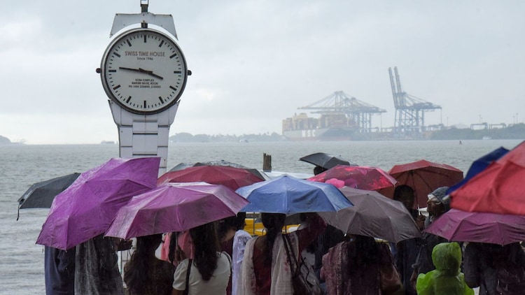
Kerala, Mahe, and Lakshadweep are expected to receive continuous rainfall activity, with isolated heavy downpours predicted for Kerala until May 27.
Fishermen have been strictly advised against venturing into the Gulf of Mannar, the south Bay of Bengal, and along the Kerala and Karnataka coasts on Sunday, May 24 due to turbulent sea conditions.
East and Northeast India are experiencing their own share of turbulent weather on Sunday, driven by multiple lower tropospheric cyclonic circulations over south Bihar and central Assam.
The weather office has forecast isolated heavy to very heavy rainfall over Assam, Meghalaya, and Arunachal Pradesh.
Significant rainfall has already been logged in the past 24 hours, with Beech Tea Garden in Sub-Himalayan West Bengal recording 18 centimetres of rain and Akbarpur in Assam recording 16 centimetres.
This severe wet spell is accompanied by thundersqualls and gusty winds ranging from 50 to 70 kilometres per hour on Sunday, particularly over West Bengal, Odisha, Bihar, and Jharkhand.
The weather office warned that these heavy rains could lead to localised flooding of roads, waterlogging in low-lying urban areas, and localised landslides in hilly terrain.
Source: India Today

